|

|
||

|
The Monklands area we will be referring to is not the old "Monklands District Council" area, but is based upon the original area owned by the Monks. The towns in the list opposite are not representative of the area.
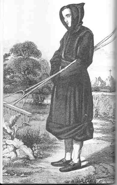
The name of Monklands dates back to 1323 (the name was first recorded in the Steward's Charter of the year) but there is evidence of settlement by hunter-gatherer tribes as far back as the Mesolithic Age (c6500-4000 be). Bronze Age remains have been discovered in the area, and there is an Iron Age Crannog site in Lochend Loch. The area roughly corresponding to the old Monklands District was gifted by Royal Charter of King Malcolm IV to the Cistercian Abbey of Newbattle in 1162. Over the years the monks leased their land to private individuals and at the time of the Reformation the whole area passed into private ownership. In the year 1162 King Malcolm IV gifted, by Royal
Charter, to the Cistercian Abbey of Newbattle, all the land that was later to became
known as Munkland or Monklands. In
1224 this was confirmed but now also mentioned the land that lies along the
(Clud) Clyde
at Kermil or Kermyle (Carmyle). The Monks Road entered the Monklands from
Torphichen, on
the Auchengray estate, passing to the north of the mansion house then along the
Hillhead of Eastfield and the estates of Caldercruix, Arden, and
Arbuckle, through
Browniesside Farm till it entered the lands of Colliertree, along Aitchison Street (the
Hogs Back), turned north at what is now Manor Drive (parallel to the aptly named
MonksCourt Avenue), past a small pond on the Airdrie estate, across "The Moss",
past Kippsbyre. Here the road is believed to have forked, the main route to
Drumpelier continued west, crossing the Northburn at Kippsbrig, along Burnbank Street,
Sunnyside, crossing the Luggie Burn at (old Coatbrig along Buchanan Street until it
entered the lands of Drumpelier at Langloan. Over the years the monks leased out portions of their land
to private individuals. They set up a courthouse or chapel and a tithing centre at Kipps
(known at various times as Kyps, Kip or Kyp or Kippis), on the banks of Cullen's Burn
(named after the long gone Cullens Farm), not far from the Cromlet. (Note Cullen's Burn is formally called the Gartsherrie Burn.) Most of the area around the north of Coatbridge and Airdrie was known as Kip or Kyp or Kipps. It is believed that Kipps land extended to Coatdyke in the south and to Whinhall in Airdrie. Around the time of the reformation all the land passed into private ownership. The Monks were the first to mine coal in the area. In
the 1400's a visiting dignitary witnessed "black stones" being distributed to
the poor as alms. In the 1500's these stones had become known as "black
gold".
Agriculture remained the main industry up until the late
1700's when the Monklands started mining. Coal and Ironstone were being found on almost
every farm. The Monklands Canal was developed to transport the minerals to suitable
markets. The Iron industry flourished with the availability of the coal and the Blackband
Ironstone. This created a boom in building and quarrying began to meet the demand
for the increasing population. Bricks were needed for housing, factories and
furnaces - brickworks sprang up in almost every area. Coatbridge was rapidly turning into the Iron Burgh. Other villages devoted to mining or quarrying sprung up all over the area - Annathill, Plains, Glenmavis, Longriggend, Baillieston, Irish immigration
Emigration
to
Scotland
from
Ireland
was
common.
Tickets
aboard
ships
were
cheap
and many
came to
work
temporarily
around
harvest
time
when
there
was work
available
in the
fields.
The Irish people suffered the Great Famine when potato blight decimated the crop. Much of Ireland's best pastureland had been given over to rearing cows for beef to sell to Britain. The native Irish population depended on the potato crop for their survival and now faced starvation. In 1841, census results showed that 4.8% of the population of Scotland was Irish-born (126,321 out of a total population of 2,620,184). In ten years that figure grew to 7.2%. Between 1841 and 1851 the Irish population of Scotland had increased by 90% to stand at 207,367. Almost a third of Irish immigrants settled in Glasgow to find work in the industries that flourished along the Clyde and in the Monklands. In 1851 it was estimated that the majority of dock workers and miners in Britain had been born in Ireland. Many Catholic Irish immigrants faced discrimination and bigotry in Presbyterian Scotland. The Irish communities grew strong funding churches and schools. In the late 1870s and 1880 large numbers of Ulster Protestants immigrated to Scotland. They brought with them their Orange traditions. Over the years Irish immigrants have done much to enrich the culture and economy of Scotland.
MONKLAND PLACE-NAMES
| ||
|
||||||||||||||
|
Copyright
Monklands
Memories 2000-2017 |
||||||||||||||